
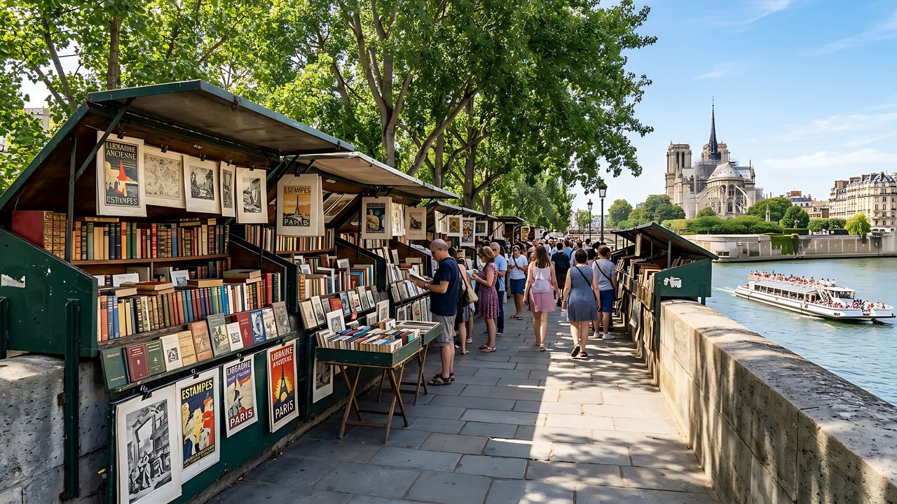
Within a 20-minute walking distance from the entrance of the Musée d'Orsay, you can find the musée de la Légion d'honneur (approximately 400 meters, 5 minutes), the booksellers of the quai Voltaire (approximately 300 meters, 4 minutes), the Jardin des Tuileries via the bridge (approximately 750 meters, 10 minutes), the Assemblée nationale (approximately 900 meters, 12 minutes), and, further away, Saint-Germain-des-Prés (approximately 1.1 km, 15 minutes). These distances were calculated using the pedestrian routing service of OpenStreetMap; the margin is approximately one hundred meters.
The Musée d'Orsay is located in the former Orsay station, on the left bank, in the 7th arrondissement. The area surrounding it doesn't resemble an organized leisure district: an 18th-century palace faces its esplanade, along with government ministries, quays lined with bookstands, and, a quarter of an hour away, the cafes of Saint-Germain. This page gathers information that can be added to a visit without taking the metro, with dates that allow you to verify each location.
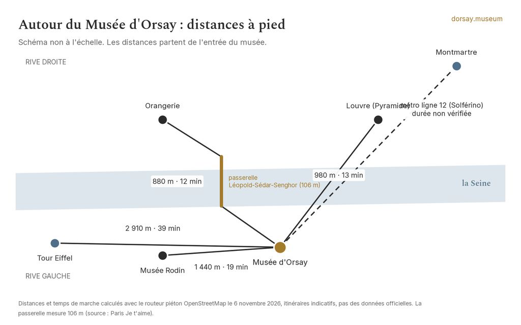
For distances to the Louvre, the Orangery, the Rodin Museum, and the Eiffel Tower, we will not repeat them here: they are on the page Musée d'Orsay + Louvre and other attractions. This page describes what is located between these museums.
What are the places worth visiting on foot near the Musée d'Orsay?
| Location | What it is | Walking distance from the entrance | Why visit? |
|---|---|---|---|
| Voltaire Quay and booksellers | The parapet wall on the left bank, where the green boxes are lined up | Approximately 300 meters, 4 minutes | The shortest possible walk: books, prints, and a view of the Louvre |
| Museum of the Legion of Honor | National museum located in the Hôtel de Salm, facing the museum's entrance | Approximately 400 meters, 5 minutes | A private mansion from the 18th century, along with its decorations, located near the entrance |
| Léopold Sédar Senghor Bridge | Pedestrian bridge connecting the Solférino dock and the Tuileries dock | Approximately 500 meters, 7 minutes | Crossing the Seine without using a road bridge |
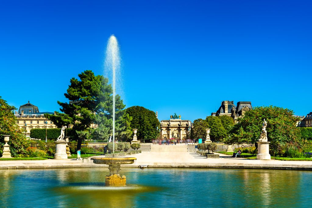
| Tuileries Garden | French-style garden, designed starting in 1664 by Le Nôtre | Approximately 750 meters, 10 minutes | A park where you can walk before or after your sessions |
| Deyrolle | Established in 1831, this business specializes in taxidermy and entomology, and is located at 46 Rue du Bac | Approximately 600 meters, 8 minutes | A natural history cabinet, located in a 17th-century hotel |
| Bourbon Palace (National Assembly) | The building that houses the National Assembly, constructed between 1722 and 1728 | Approximately 900 meters, 12 minutes | The facade facing the Place du Palais-Bourbon |
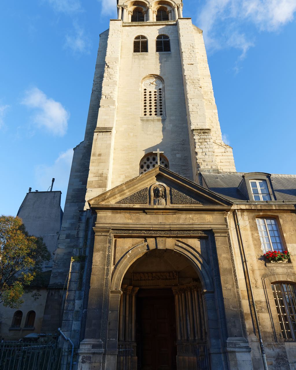
| Saint-Germain-des-Prés Church | Heart of the historic café district | Approximately 1,200 meters, 16 minutes | Houses on the other side of the street: Flore, Deux Magots, Lipp |
| Sainte-Chapelle Chapel | Distance marker to the Île de la Cité (Island of the City) | Approximately 1,700 meters, 23 minutes | To locate the Île de la Cité on a map |
| Notre-Dame Square | Landmark indicating the distance to the esplanade, on the right bank of the island | Approximately 1,900 meters, 25 minutes | To measure the distance to the cathedral |
What are the Salm Palace and the Museum of the Legion of Honor?
Upon exiting the esplanade, the building directly in front of you is the palace of the Legion of Honour, otherwise known as the Hôtel de Salm. It was built in the last decades of the 18th century, according to the plans of Pierre Rousseau, at the initiative of Frederick III of Salm-Kyrbourg. It has belonged to the Order of the Legion of Honour since 1804; it was renovated at the end of 1812 by the architect Antoine-François Peyre, and classified as a historical monument in 1985. It houses the Grand Chancellery and the museum of the Legion of Honour, located at 2 rue de la Légion-d'Honneur, "facing the esplanade of the Musée d'Orsay," according to Wikipedia.
The museum is a national museum dedicated to orders of chivalry and merit, as well as decorations and medals, both French and foreign. It is independent of the Musée d'Orsay, and its access rules are its own: we do not describe them; please read them on its website. Even without entering, the grand entrance hall on the Lille Street side offers a glimpse of the courtyard.
Why go back up Voltaire Quay?
The Quai Voltaire begins approximately 300 m from the entrance, and is the shortest of the walkways. The booksellers have fixed stalls attached to the parapet. Their history dates back to 1859, with ten meters of parapet per bookseller, and the current stalls were officially established in 1891. On the left bank, they extend "from the Quai de la Tournelle to the Quai Voltaire," meaning that you are here at the end of the row. The profession has been registered as part of France's intangible cultural heritage since February 6, 2019, and the banks of the Seine have been listed by UNESCO since 1991.
These stalls are not traditional shops with fixed opening hours; each bookseller decides when to open, so we don't specify any days or times. It's perfectly fine to come without intending to buy anything; you can stroll along, admire the Seine, and look at the facade of the old train station.
How can I get to the Tuileries Garden from the Musée d'Orsay?
You can reach the Tuileries via the Léopold-Sédar-Senghor footbridge, formerly the Solférino footbridge, which connects the port de Solférino (7th arrondissement) to the port des Tuileries (1st arrondissement). Allow about 500 m, or seven minutes, to reach the middle of the bridge, then continue to the garden entrance. The full route to the entrance near the Pont Royal is about 750 m, or ten minutes. Catherine de’ Medici began laying out the garden in 1564, and Le Nôtre redesigned it from 1664 onwards. It has been listed as a historic monument since 1914 (according to the Mérimée database, it has formed part of the Domaine national du Louvre et des Tuileries since 2017) and is managed by the Louvre’s public institution.
On the Orsay side, a painting reminds us of the proximity: Giuseppe De Nittis painted in 1882 La Place du Carrousel, ruins of the Tuileries (inventory DO 2022 1, according to the museum's record), and the square is about 750 m from the entrance, about ten minutes away. The Tuileries Palace, which closed it off, has disappeared, but the Carrousel Arch remains. The details of the places depicted in the painting, including those that are no longer there, can be found in The Paris of the Orsay Paintings.
What are the must-see places at the National Assembly, on Rue du Bac, and at Deyrolle?
The Palais Bourbon, the seat of the Assemblée nationale (National Assembly), is located approximately 900 meters away. It was built between 1722 and 1728; the Council of Five Hundred met there starting on January 21, 1798, and the lower house of Parliament has met there again since 1879 (the National Assembly since 1946). You are more likely to walk past it than to visit it: access conditions are those of the institution, and we will not comment on them.
Approximately 600 meters away, at 46 Rue du Bac, Deyrolle is a company founded in 1831, specializing in taxidermy and entomology, located in a 17th-century building. Be aware of a date that is sometimes repeated: the company dates back to 1831, but its arrival at this address is given as 1881 by one source and 1888 by another. Therefore, we do not specify a year for the address.
Saint-Germain-des-Prés, a fifteen-minute walk away
The church of Saint-Germain-des-Prés is approximately 1,200 meters away, about sixteen minutes. Around it are Les Deux Magots (1884), the Café de Flore (1885), and the brasserie Lipp (1880), which are about fourteen or fifteen minutes away. These establishments, along with other historical addresses in the area, are detailed on the page about where to eat near Orsay. To find accommodation, see the page about the neighborhoods where to stay.
How can these places be connected to create a walking route?
This itinerary avoids having to retrace your steps. Not all distances between stops are calculated; those listed in the table are measured from the museum entrance.
- Exit the museum and walk towards the Quai Voltaire (4 minutes).
- Head back towards the Rue de Lille to see the portico of the palais de Salm (5 minutes from the entrance).
- Join the rue du Bac, and if you are interested in the natural history shop, visit Deyrolle (8 minutes from the entrance).
- Continue towards Saint-Germain-des-Prés for a break (16 minutes since the entrance).
- You can return by bus, or on foot along the pier, depending on the time.
An alternative route: cross the Seine using the footbridge, stroll through the Tuileries, and return via the Pont Royal. This option is better suited for the end of the day.
If you're short on time, consider these options based on walking distance: less than five minutes, the Voltaire platform; less than ten minutes, the Legion of Honor, Deyrolle, and the Tuileries; less than twenty minutes, Saint-Germain-des-Prés. To plan your visit to the museum itself, see the page about the duration of a visit.
Why are the distances on this page "calculated"?
A straight-line distance means nothing to a pedestrian: you have to go around a closed street, cross a bridge, wait at a traffic light. Therefore, we consulted the OpenStreetMap pedestrian routing service, starting from the museum entrance point (2.3266; 48.8600) to geocoded arrival points in OpenStreetMap (address or center of each location). The durations are calculated at a normal walking pace. Three consequences: the figures are estimates within a hundred meters, they do not take into account your pace or any construction work, and they are calculated from the entrance, not from the metro station. If a distance influences your decision, measure it on your own map before booking an activity.
How can I get to the neighborhood without walking?
The museum indicates, on its "Visiting the Museum" page, that you can reach it via line 12 of the metro (Solférino station), the RER C (Musée d'Orsay station), and buses 63, 68, 69, 73, 83, 84, 87, and 94 (information retrieved in November 2026: bus routes may change). The RER station is less than 350 meters from the entrance. For museum entrances during construction, please see the page on access and opening hours.
Frequently asked questions about the neighborhood
What are some things to see on foot near the Musée d'Orsay?
The Musée de la Légion d'honneur (approximately 400 meters), the booksellers along the Quai Voltaire (approximately 300 meters), the Tuileries Garden (approximately 750 meters), the French National Assembly (approximately 900 meters), and Saint-Germain-des-Prés (approximately 1.1 kilometers). All distances are calculated using OpenStreetMap.
Is the Musée de la Légion d'Honneur located opposite the Musée d'Orsay?
Yes: It is located at 2 Rue de la Légion d'Honneur, "facing the forecourt of the Musée d'Orsay," according to Wikipedia. Access to the Musée de la Légion d'Honneur is separate from access to the Musée d'Orsay.
How long does it take to walk to the Tuileries Garden?
It takes approximately ten minutes to walk about 750 meters to the access point near the Royal Bridge, and about 500 meters to the Léopold Sédar Senghor pedestrian bridge.
Are the booksellers along the Quai Voltaire protected?
The profession has been recognized as part of France's intangible cultural heritage since February 6, 2019; the banks of the Seine River have been listed as a UNESCO World Heritage site since 1991.
Where is the nearest RER station?
The Musée d'Orsay RER C station is less than 350 meters from the entrance, approximately a five-minute walk.
Are the distances accurate?
They are calculated based on the pedestrian network in OpenStreetMap, using points that we ourselves have placed. Please note that these locations are approximate, with an accuracy of about 100 meters.
Where can I eat and stay in this neighborhood?
Learn more
Eating, lodging, viewing painted artworks, or connecting museums.
Where to eat
The museum locations and historical houses of Saint-Germain.
Where to stay
The neighborhoods were compared based on their connections to Orsay.
Paris: A City of Paintings
The real-life locations depicted by the Impressionists.
Visits to the Musée d'Orsay, the Louvre, and other museums
Distances to the Louvre Museum, the Musée de l'Orangerie, and the Rodin Museum.
Data verified on . Distances calculated using OpenStreetMap; foundation dates and information based on Wikipedia and the websites of the houses mentioned; connections based on the museum's website. Politique éditoriale